
Conquering Mahoosuc and Southern Maine
Day #: 81
Miles Since Last Update: 129 mi.
Total Miles Hiked: 1,021 mi.
Miles Remaining: 1,176 mi.
This post can originally be found here, on The Trek.
Even before entering New England, amidst conversation of The Whites and Mt. Washington, I would hear snippets of hikers saying “southern Maine is the hardest part of the trail”.
Which, for the record, no one wants to hear that there is a part of the trail that is HARDER than the Whites.
While staying at Chet’s, Pork Roll, who completed the AT a few years back, informed me that one of the slowest and most challenging miles on the trail is Mahoosuc Notch, followed by the Mahoosuc Arm.
- For clarification purposes, according to this article I found by NatGeo, “a gap is a low area between two higher-elevation landmasses, such as mountains. Gaps are similar to passes, but more rugged and difficult to navigate. The most rugged gaps are often called ‘notches.’ Notches are rarely crossed, and usually marked by steep cliffs on either side.”
- Why the following 1 mile of trail, which requires a steep climb of 1500 feet, is called an “arm” is still a mystery to me.
Mahoosuc Notch
Mahoosuc Notch is a gorge filled with massive boulders, some as big as houses. Hikers are forced to navigate over, around, and sometimes through holes between these large boulders, making this mile of trail not so much physically taxing as it is mentally taxing and technically difficult. Add 40-60 liter backpacks to the equation, throwing off your balance and doubling your width, and it gets even more complicated.
Needless to say, I was looking forward to it.
Getting to Mahoosuc Notch
However, before the fun could begin, we had to get there first. Which was a feat unto its own. We had to climb over Goose Eye West, East, and North Peaks, all while avoiding mud pits, climbing up and down steep rails, and overall being pushed around by strong gusts of wind any time we didn’t have trees to protect us.


Until finally we made it to the Notch.
In the Notch

The temperature dropped immediately as soon as we climbed down into the notch. This was because within the crevasses of boulders, ice still lingered. Rumor also had it that within the middle of the notch, the ice melted and from it flowed such pure, delicious water that filtering was unnecessary. Hikers lovingly referred to it as the fountain of life, and I was determined to drink from it.

Popeye, Recon, and I then proceeded to make our way through the Notch. As you may remember, Popeye had injured her ankle in the Carter Mountains, but she was a champ and she pushed through the Notch despite any pain she was experiencing.


Around 20 minutes in and we came to the foretold water. It was clear, cold, and so delicious that I forgot to take a photo of it for you guys! SO sorry! I guess the mystery and wonder of this magical spring shall continue.
Climbing Up Mahoosuc Arm
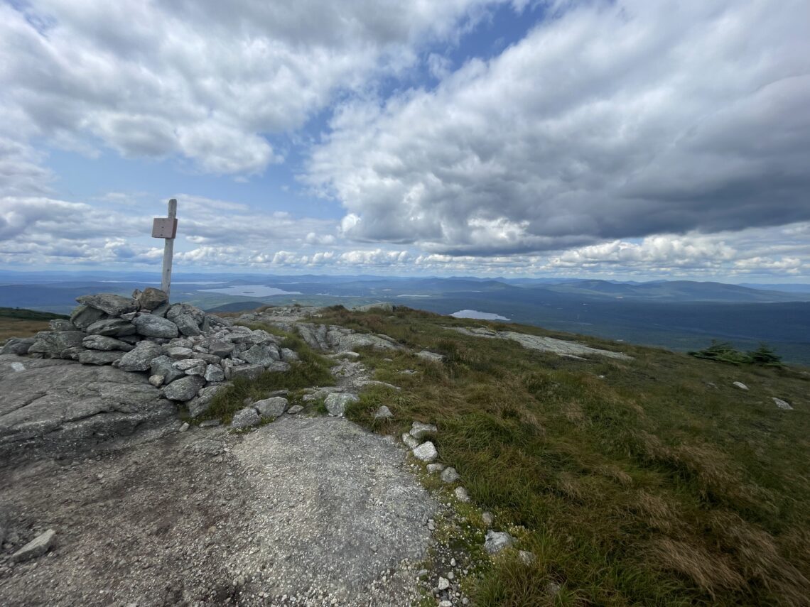
As I explained before, after the Notch was the Mahoosuc Arm, a savage, steep mile made up of long slippery slabs of rock that gave no rest to its weary climbers. It did, however, reward with a beautiful view at the top.

After the Arm, we stayed the night at Speck Pond Shelter, which is supposed to be a really nice shelter set next to a gorgeous pond! Unfortunately, we didnt get to experience this supposed beauty because (drum roll please) you guessed it! It started raining.
Other highlights of hiking Southern Maine
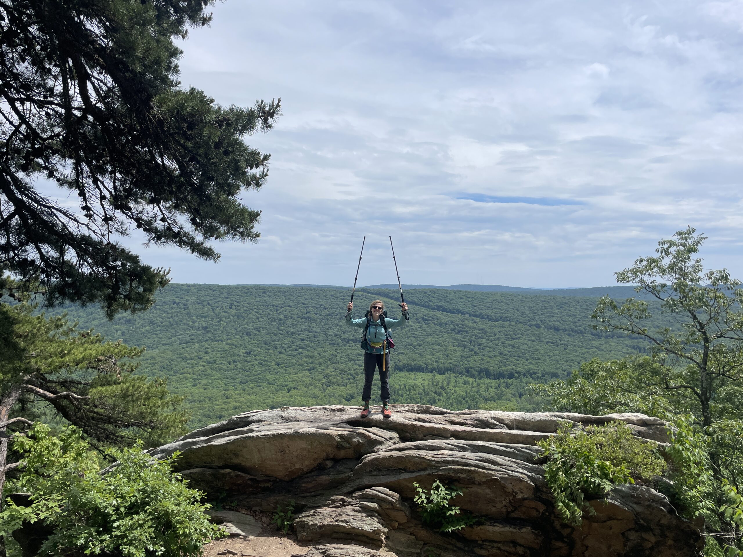
After completing the Mahoosuc trail, I waved goodbye to Recon and Popeye who were going into the town of Bethel for resupply and rest. This day was also the day that us hikers got to switch over to our very last section of FarOut (for me it was the last Far Out section of my NOBO hike). I pushed on, aiming to resupply in Andover instead of Bethel. On my way, I crossed over Bald Plate Mountain which was, as you may expect, a mountain “bald” of trees. So it was gorgeous, but windy. Luckily, here I got a sunny day.


In over to get to Andover, I rounded up some other hikers to share the cost of a shuttle into town. There, I got to try Moxie for the first time! It is apparently a Maine soda. It was decent. I didn’t love it; I didn’t hate it.

Continuing on, I stayed at some really nice campsites, picked up a postcard from Tyler, and climbed many, many more mountains.


In a continued effort to save money, I posted on a variety of facebook pages, and was connected with an AT thru-hiker who completed the trail in 2020. She lives near the trail in Maine, and offered for me to tent in her backyard so I did not have to pay for a hostel. By the time I made it to hers, I hadn’t showered or done laundry in a couple weeks. She was super kind, letting me shower and do laundry at hers, and we got along immediately. We grabbed a dinner together of pizza and ice cream, talked about the trail, how we hike, and learned we have a lot of similarities. I learned that after hiking the AT, Jackie loved Maine so much that she left everything behind and moved up here. She now has created The Girls Trip Adventure Co. where she leads backpacking and adventure trips for women, which is awesome! The following day was supposed to rain so she offered to let me zero at hers. After all the rain I had been dealing with over the past few weeks, it was a no brainer. The next day all I did was lie on her couch, sleep, eat, and sleep some more. It was what I needed to be rejuvenated enough to get back on the trail the next day to hike the Bigelow’s, the last large mountain I would hike until the 100 mile wilderness.

As I hiked the Bigelow’s, I began leapfrogging with a woman, who’s name I later learned was Cindy, a local from Maine who loves to hike. As we both crested to the top of the last peak, a group of girls were there (on some kind of summer outdoors week-long experience) and they cheered for us! It was really fun. Cindy and I took photos, and Cindy showed me the stuffed Moose she carries with her which I thought was awesome. Before we split, Cindy to her car and me to continue on the trail, Cindy told me to reach out to her if I had any issues. I continue to love just how kind and thoughtful the people I meet as I hike are.


Some other Southern Maine Short Stories
Being full of roots, and with my legs perpetually fatigued, I tripped and ripped my shoes and socks a lot. Slowly growing the rip in my shoe until my until big toe could taste fresh air.


I found that there was a plethora of wild blueberries on the trail that I could harvest and enjoy as I hiked.

And another of my favorite campsites: Flagstaff Campsite, on a beach beside Flagstaff Lake.


Up next: The Kennebec River, Northern Maine, and one of my favorite breweries on the entire trail.


One Comment
Alice M. Clark
Cody,
I continue to LOVE reading your posts. Thank you for taking on this adventure so I can enjoy it with you. Amazing pictures. Thank you for taking so many. I keep thinking that this is the beginning of a book that needs to be written. I think your style of writing is fabulous and would love others to be able to enjoy this adventure as well.
Just love all of the kindness you are experiencing!